


Route 1 can trace its origins in part to the 17th century.
The U.S. highway that runs through this area was once part of a system of roads connecting the colonies called the King’s Highway.
Named for King Charles II of England, who ordered it be built, the 1,300-mile road was laid out from 1650 to 1735, stretching from Boston to Charleston, South Carolina. First started as a postal route, it later handled stagecoaches and wagons.
The highway had various names along the way, including the Boston Post Road, the Potomac Trail and the Virginia Path. South of Annapolis, the stretch of road was often called the Great Coastal Road.
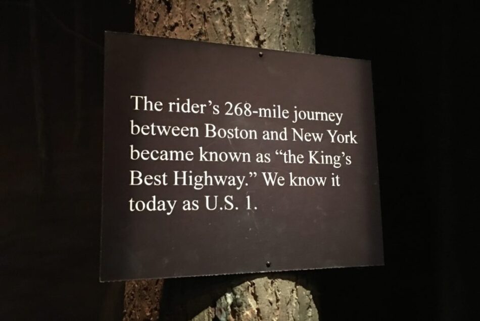
The National Postal Museum in downtown D.C. has an exhibit which references the “King’s Best Highway,” known today as Route 1, and tells the story of how it was a popular mail route that was for many generations just a path wide enough for a few wagons.
The Hyattsville Wire couldn’t find a detailed map of the highway as it went through this area, but there are references to it passing through Bladensburg, just south of downtown Hyattsville.
Route 1 runs 2,369 miles, from Fort Kent, Maine, at the border of Canada to Key West, Florida.


%20ROUTES%20VA,%20NC,%20SC,%20GA/KINGS%20HIGHWAY%20-%20Permanent/KH%20(entire%20Route).jpg)