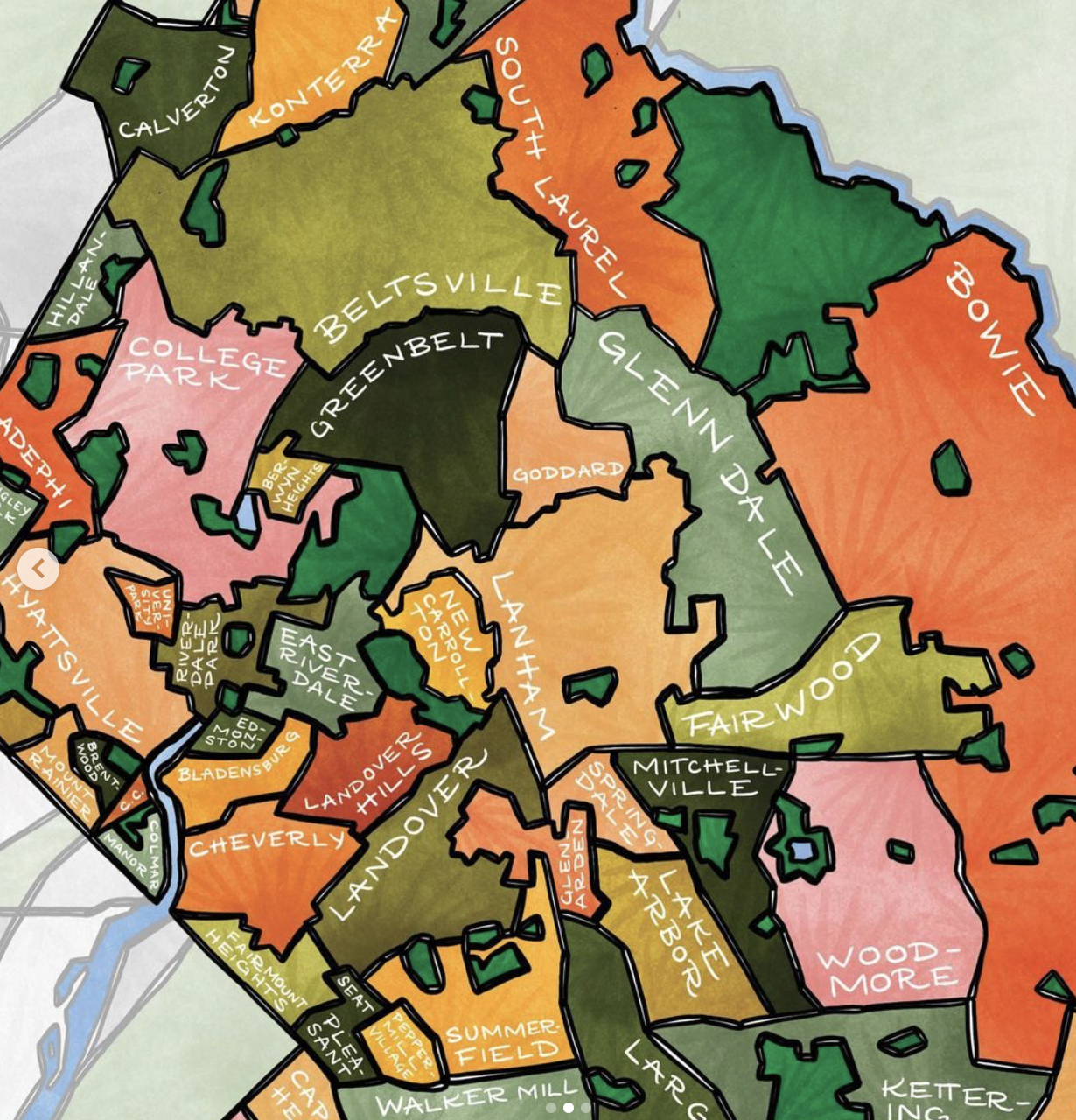
A Mount Rainier designer who specializes in artistic maps of D.C. neighborhoods has added a new map of Prince George’s County to her colorful collection.
Torie Partridge, owner of graphic design firm Terratorie, first began the Neighborhood Maps Project in 2012.
She’s already made maps of Mount Rainier, Hyattsville, Cheverly, College Park, Brentwood and North Brentwood. If you want to see another Route 1 neighborhood added to the collection, you can make a request on the Terratorie website.
“I’ve had an overwhelming number of requests to create Prince George’s County,” Partridge told the Hyattsville Wire. “P.G. County residents had so much pride and excitement for their area, so it was a natural fit for us to create it. It doesn’t hurt that it’s my home county!”
Partridge, who says she is considering a Montgomery County map next, said she chose bright colors for this map.
“Prince George’s is vibrant, bright, energetic, and creative. I wanted the color palette to reflect that,” she said.
The hand-illustrated map features all of the towns and neighborhoods in the county, including the Route 1 corridor from Beltsville to Mount Rainier, as well as major local parks.
The map is available as a 13-by-19-inch unframed art print, as a matted and framed art print in an 18-by-24-inch frame or as 5-by-7-inch greeting cards.
You can buy the maps on Partridge’s website or at her shop in Brookland’s Arts Walk at 716 Monroe St. NE, Studio 24, from 10 a.m. to 4 p.m. on Saturdays.
Support the Wire and Community Journalism
Make a one-time donation or become a regular supporter here.





Looks beautiful! Pretty handy too. I’ll probably get some.